Welcome to the Llanfoist to Abergavenny Active Travel Bridge and Links August newsletter
Stakeholder Site Visit
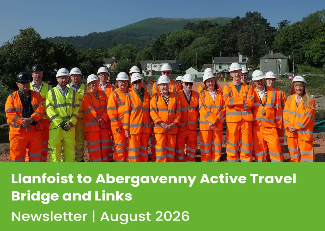
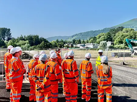
Representatives from Monmouthshire County Council (MCC), key project stakeholders and partners, recently joined the Balfour Beatty team for a site visit to see first-hand the progress being made on the Llanfoist to Abergavenny Active Travel Bridge scheme.
The project will provide a new walking, wheeling and cycling connection across the River Usk, creating a more direct and sustainable link between Llanfoist and Abergavenny.
The visit enabled stakeholders to develop a greater understanding of the scheme, equipping them with valuable information that they can share with their wider community as the project progresses.
Community Engagement
In July, Balfour Beatty welcomed members of the local community to a drop-in engagement clinic. The event formed part of the project’s ongoing commitment to keeping local communities informed and engaged throughout delivery, while providing a valuable forum for the project team to address questions and concerns raised by residents and stakeholders.
We were delighted by the positive turnout and would like to thank everyone who took the time to attend. Stakeholder engagement remains an important part of the project, helping to keep partners informed as works continue to progress.
We look forward to welcoming stakeholders back to site in the future and continuing to share updates as the project moves towards completion.
Questions Raised at the Drop-In clinic
A number of questions were raised by attendees at the community drop-in clinic. The key topics discussed, along with responses from the project team, are provided below.
Further information is also available on the project’s dedicated Frequently Asked Questions page https://abergavennyactivetravelbridge.co.uk/frequently-asked-questions/
Will there be a gate on the meadow side to stop cows walking onto the bridge and shared-use path, and who will be responsible for cleaning up animal waste?
Cattle will be prevented from walking onto the bridge by gates. The bridge design includes gates at the Castle Meadows side landing, similar to the gate at the Castle Hill entrance to the Meadows. The gate design was selected to provide the least restrictive access for people walking, wheeling and cycling. As with the historic arrangement, the cattle will be able to walk around the Meadows, and will be able to cross the paths. We do not plan to clean up the occasional cow pat that may be left on the paths, as these are part of the natural life of the Meadows. As normal, however, dog owners must pick up after their dogs.
Will there be bollards halfway along the bridge to prevent collisions between cyclists and pedestrians, using it at the same time?
There are no additional bollards proposed on the bridge itself. The bridge design includes a single bollard located at the southern (Llanfoist) approach to the bridge to prevent vehicular access, positioned at the entrance to the structure.
Will cows still be allowed to graze when people are using the bridge, and will there be any fencing to stop them using the same footpath?
There are no proposals within the project to install fencing to prevent cattle from crossing the path. Cattle will continue to seasonally graze Castle Meadows to maintain the sensitive ecology in adherence to the Castle Meadows management plan. Access to Castle Meadows will be controlled by slow closing, latch-free gates, as previously trialled at the Castle Hill entrance.
Why did the project not consider low-level lighting to improve safety for young people and other members of the public?
No. Lighting was excluded from the scheme plans following consultation, and there are no plans to include lighting within the scheme. Early designs considered the provision of lighting along the bridge and connecting paths; however, following stakeholder and public consultation, lighting was removed from both the bridge and Castle Meadows proposals.
This decision took into account the setting of the bridge within the Site of Special Scientific Interest (SSSI) and the Special Area of Conservation (SAC).
Could a pedestrian crossing be provided to allow people to access the bridge from the old bridge side?
The scheme includes works on Merthyr Road, Llanfoist, to improve crossing facilities and active travel connections. This forms part of a wider aspiration to improve routes on the Llanfoist side of the River Usk and strengthen connections to the Active Travel Bridge and Castle Meadows. Some elements of this wider scheme will be delivered as part of the current construction works, with additional sections progressing as funding becomes available.
Plans for Merthyr Road, Llanfoist, will be shared at the next stakeholder event, (details to be confirmed).
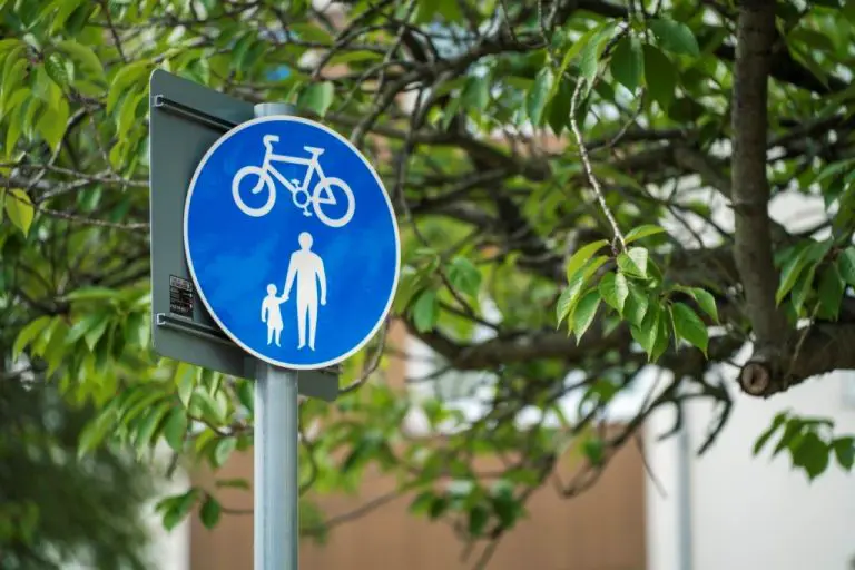
Are cyclists permitted to ride across the bridge, or will they be required to dismount? If dismounting is required, can appropriate signage be installed?
The bridge will be a ‘Shared Use Path’, and cyclists will be permitted to use it. Shared use path signs (TRSGD diagram 956) will be used to indicate this.
What will happen to the footpaths that have been affected by the works?
During construction of the active travel bridge and ramps, Public Rights of Way (PROW) diversion paths will be in place. The temporary footpaths associated with the construction works will be removed by Balfour Beatty when no longer required.
Paths that were part of planning permission for the active travel bridge and ramps will be constructed from a permeable resin-bound surfacing over an asphalt concrete base and hardcore sub-base. The detail of the path construction and surface specification can be seen on planning application DM/2018/00408, drawing DR-CB-0109 P1, ‘KERBS, FOOTPATHS AND PAVED AREAS DETAILS’. This detail received planning approval as DM/2023/00900 Discharge of condition no.5 (landscape works) of planning consent DM/2018/00408.
Planning documents can be viewed via https://planningonline.monmouthshire.gov.uk/online-applications/
Further paths on Castle Meadows may be developed subject to funding, based on the planning permission DM/2022/01831. The makeup of these paths will be subject to approval by the Local Planning Authority (as Condition 4 of the planning permission) and the Sustainable Urban Drainage Systems Approval Body (SAB).
What will happen to the tarmac area currently occupied by the site cabins and compound?
The site compound and associated hardstanding will be removed, and the area reinstated and reseeded by Balfour Beatty. The temporary compound materials (hardcore and tarmac) will be recovered and re-used.
Will there be enough topsoil to complete all reinstatement works?
Topsoil and ramp infill material will be sourced from local quarries that can demonstrate compliance with the project specification, the Specification for Highways Works and the project’s Construction Environmental Management Plan (CEMP). Where practical and compliant with the relevant specifications, excavated material from Castle Meadows will be reused within the scheme.
Can the landscaping plan be shared externally?
The landscaping plan can be seen on diagrams, ‘SOFT LANDSCAPE DETAILS ‘, ‘LANDSCAPE PLAN [1 OF 2]’ and ‘LANDSCAPE PLAN [2/2]’, This detail received planning approval as DM/2023/00900 Discharge of condition no.5 (landscape works) of planning consent DM/2018/00408. Planting and seeding species details are being updated, following feedback from ecologists.
Have any archaeological surveys been undertaken on the excavated areas?
The Glamorgan-Gwent Archaeologist Trust (now called HENEB) were consulted as part of the original planning application and did not require surveys at the time.
During site preparation, it was found that the topsoil on Castle Meadows was very shallow, due to the site’s previous use as a dump. Broken bottles and other discarded waste have been identified within the excavated soil currently stored on site.
Construction Update | July Progress
Balfour Beatty Site Compound Update
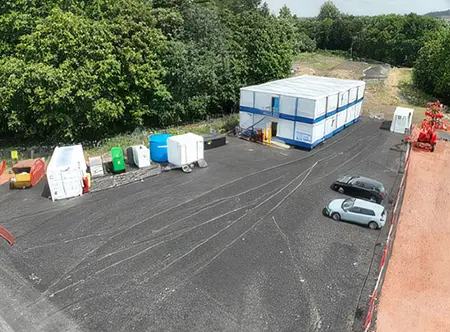
In the last newsletter, we explained how Balfour Beatty was creating the space needed to establish a site compound and access road to support both construction activities and the welfare needs of their workforce.
The tarmac surface that forms the foundation of the compound will remain in place until construction works are complete. Then, the site compound will be removed, and the meadow area will be restored, returning the land to how it was before works commenced.
North access and piling platform
Works to deliver the north access route and piling platform have now been successfully completed. The piling platform was constructed using the same methodology as the southern platform, with vegetation clearance and topsoil removal followed by the installation of a composite geotextile layer and a clean quarried 6F5 aggregate working platform.
The north access route required a different construction approach and has been formed using timber matting.
Following topsoil removal, a geotextile membrane was installed before timber mats were laid perpendicular to the direction of travel. This arrangement ensures that loads from construction vehicles and plant are effectively distributed, providing a stable and secure access route while minimising impacts on the ground beneath.
Public Rights of Way Diversion Update
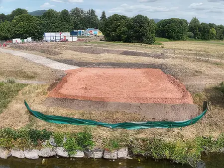
Following the information shared in our last newsletter, the Public Rights of Way (PROW) diversion has now been completed and is fully open for use.
The diversion route will remain in place for the duration of the construction works, providing safe access while enabling progress on the bridge and associated infrastructure.
We are pleased to see members of the community already making use of the route and would like to thank everyone for their patience and cooperation during its installation.
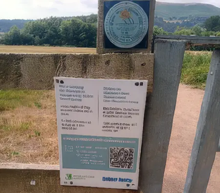
To help keep the community informed throughout the project, information boards have been installed along the diversion route.
Caisson (Mono-pile) Foundation
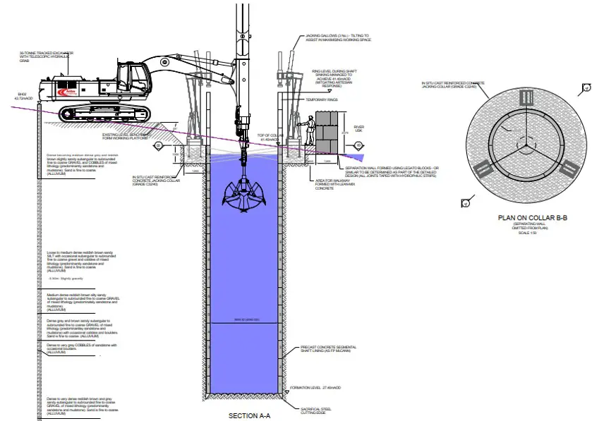
Our attention now turns towards in river works starting with the construction of the caisson (mono-pile) which as previously mentioned within the last newsletter is 3.66m in diameter and 13m deep. A caisson is essentially a large concrete cylinder that is sunk into the ground to create a very strong foundation for the bridge.
To build it, we’ll first create a temporary working area on the existing shingle bar within the river. The circular caisson structure is then lowered into the ground a little at a time. As soil and gravel are removed from inside the cylinder, it gradually sinks under its own weight until it reaches the required depth. Once the caisson is deep enough to reach strong ground, it is filled with reinforced concrete, creating a solid foundation.
The bridge pier is then constructed on top of this foundation to support the bridge. This method is commonly used where very strong foundations are needed in or near water because it provides a stable base while minimising the amount of excavation required within the river. To enable these works we must first install a ‘cofferdam’ to ensure safe construction and protect our team from the risk of working within and below the river.
To enable these works we must first install a ‘cofferdam’ to ensure safe construction and protect our team from the risk of working within and below the river. A cofferdam is a temporary watertight structure built within or around a body of water to create a dry and safe working area for construction activities. The cofferdam will be constructed by installing sheet piles and frames to provide support from the external pressures that are exerted onto it as the top of the caisson is circa 2m below the existing ground level.
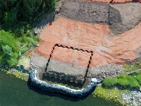
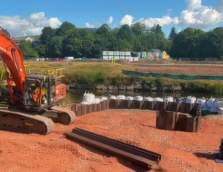
Once complete the caisson is constructed utilising cutting ring supported by a concrete collar, pre-cast concrete segments are then placed around the perimeter that are pushed into the ground with jack rams and excavated out as the construction progresses deeper, excavation works will be carried out using an excavator and clam shell attachment adjacent utilising the already installed working platform.
Once at depth the caisson will be reinforced with steel before being filled with concrete and capped to the allow follow on construction of the pier.
Social Value and Community Engagement
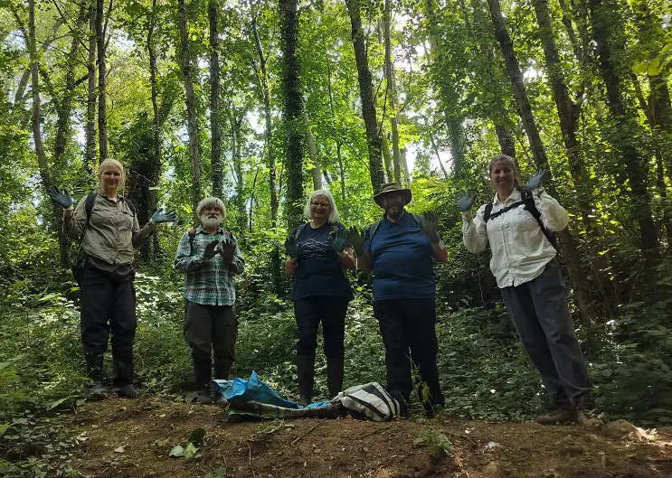
Balfour Beatty recently made an in-kind donation of 30 pairs of new protective gloves, valued at £130, to support volunteers from Gwent Wildlife Trust undertaking conservation work along the River Gavenny.
The gloves were used during efforts to remove invasive Himalayan balsam from Daffodil Banks, helping volunteers clear approximately 1 kilometre of river corridor.
The activity contributes towards both biodiversity enhancement and environmental conservation outcomes, while supporting local ecological initiatives linked to the project.